


Trail Overview & Technical Specs
- Distance: 13.5 km (one-way)
- Duration: 5.5 to 7 hours (depending on your pace, lunch, and photo breaks)
- Elevation Gain: Around 600 meters (1,960 feet) of total ascent (D+)
- Difficulty: Moderate to Strenuous. The hike is physically demanding and features steep, technical terrain.
- Restrictions: Strictly forbidden for dogs due to the steep, vertical steel ladders. Not recommended for young children or anyone prone to severe vertigo.
Step-by-Step Trail Itinerary
Part 1: From Chalet de la Maline to Pré d’Issane
The adventure begins at the Chalet de la Maline, located along the famous Route des Crêtes (La Palud-sur-Verdon). The trail kicks off immediately with a steep, winding 45-minute descent through shaded woods down to the riverbed.
At the bottom of the gorge, you will pass near the Passerelle de l'Estellié (a footbridge crossing into the neighboring Var department toward the Imbut trail, which is currently closed due to rockfalls). Leaving the bridge to your right, continue straight ahead to discover Pré d'Issane, a gorgeous wild beach of smooth white pebbles contrasting beautifully with the emerald current.
Part 2: Through Baume-aux-Bœufs to the Mescla Balcony
After navigating the rocky scree of the Éboulis de Guègues, you will reach the Baume-aux-Bœufs, a massive natural cave carved into the cliffside. Keep your eyes on the skies here: this area is a favorite nesting site for giant Griffon and Black vultures. Look closely at the water, too—you might spot adventurers floating down the river in ultra-light packrafts.
A short distance ahead, take the mandatory 30-minute round-trip detour to the Balcon de la Mescla. This scenic overlook provides a jaw-dropping view of the exact point where the Artuby River meets the Verdon, creating a spectacular hairpin loop deep in the canyon.
Part 3: Taming the Vertigo at the Imbert Ladders
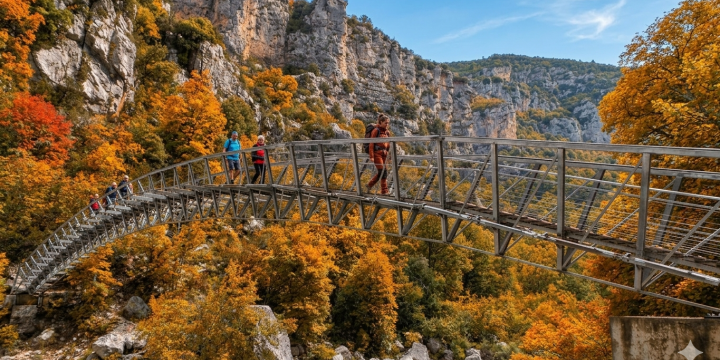
Get ready for the most thrilling and photographed section of the hike! After a short but steep climb, you will stand before the Brèche Imbert, a sheer rock fissure. To cross it, you must walk down 274 metal steps on steep ladders bolted directly into the cliff face. Don't worry: the staircases are modern, heavy-duty, and fully enclosed with handrails, though they will certainly get your adrenaline pumping!
Part 4: Into the Dark Tunnels and Couloir Samson
The path evens out slightly as you pass the Balcon des Hirondelles (Swallow's Balcony) and the Défilé des Baumes Fères, where you can enjoy another rest on a river beach. Soon, the trail takes you right into the heart of the mountain.
► Get your headlamps ready! The trail passes through three consecutive historic tunnels dug in the early 20th century for an abandoned hydroelectric project:
- The Baumes Tunnel
- The Trescaire Tunnel (110 meters long)
- The Baou Tunnel: The ultimate highlight, measuring an impressive 670 meters (0.4 miles) in complete, pitch-black darkness. Watch your step, as the ground features puddles and can be slippery!
Exiting the Baou Tunnel, you emerge directly into the Couloir Samson, the narrowest and most imposing section of the canyon, flanked by towering limestone monoliths.
Part 5: The Final Climb to Point Sublime
After crossing the Baou footbridge, you face the final uphill stretch leading to the world-famous Point Sublime lookout in Rougon. As you climb past the Baume-aux-Pigeons cave, look down into the roaring waters below: you will likely see aqua-trekkers in wetsuits floating through the rapids. It's the perfect inspiration for your next adventure—exploring the canyon from inside the water!
A Touch of History: Walking in the Footsteps of Pioneers
The trail is named after the two pioneering explorers who successfully completed the very first full navigation of the Grand Canyon in 1905: Édouard-Alfred Martel (the father of modern speleology) and Isidore Blanc (a schoolteacher from the village of Rougon), accompanied by brave local woodsmen.
Equipped and mapped out between 1926 and 1928 by the Touring Club de France, the original trail was later rerouted away from dangerous ledges, leading to the installation of the famous steel ladders you climb today.
Logistics & Practical Information
How to Get Back (Shuttle Bus & Transport)
Because the hike is a one-way trek from La Maline to Point Sublime, you need to plan your return trip:
- The Official Blanc-Martel Shuttle: Operating from spring to autumn, this shuttle bus leaves the village of La Palud-sur-Verdon in the morning to drop hikers at Chalet de la Maline, and collects them at Point Sublime in the afternoon. Note: Outside of July and August, it typically runs only on weekends and public holidays. Booking in advance is mandatory.
- Local Taxis: Private taxi services operate regularly between the start and end parking lots, offering a highly flexible option, especially during the low season.
- Two Vehicles / Hitchhiking: If traveling with friends in multiple cars, park one at the finish line (Point Sublime) and one at the start (La Maline). Hitchhiking between the two lots is also very common and well-respected among the hiking community.
Packing Essentials:
- Sturdy, broken-in hiking boots with deep tread (running shoes or smooth sneakers are dangerous on the slippery limestone).
- At least 2 liters of water per person. There are absolutely no drinking water sources along the 13.5 km trail, and summer heat in the gorge can be intense.
- A reliable headlamp or flashlight (your smartphone flash will not be bright or long-lasting enough for the 670-meter Baou tunnel).
- A small trash bag to carry out all your waste.